Combining extensive geospatial data acquisition and analysis capabilities to identify and categorise asset risk exposure and degradation, improving customers operational efficiency whilst also reducing overall costs.
Remote Monitoring
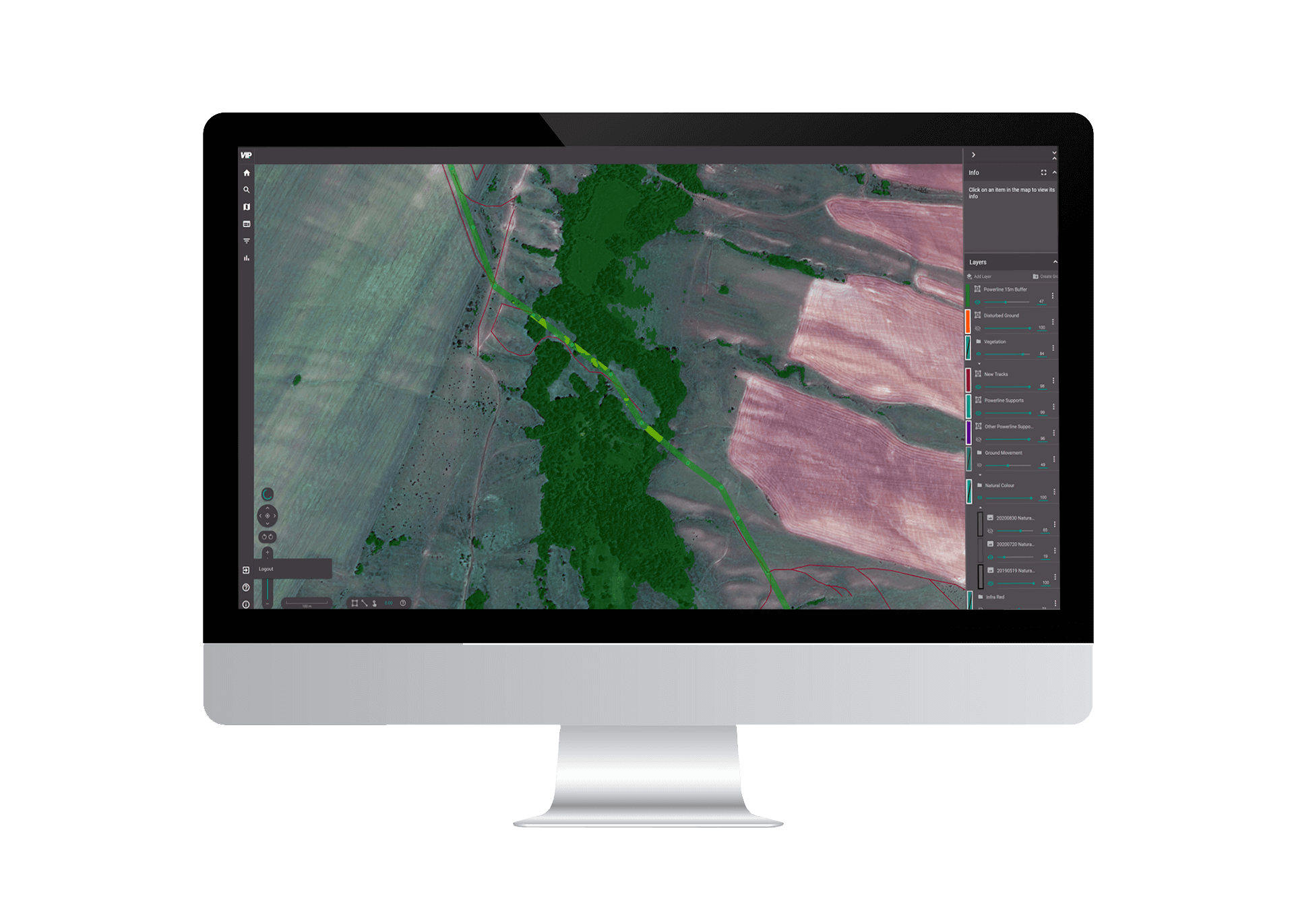
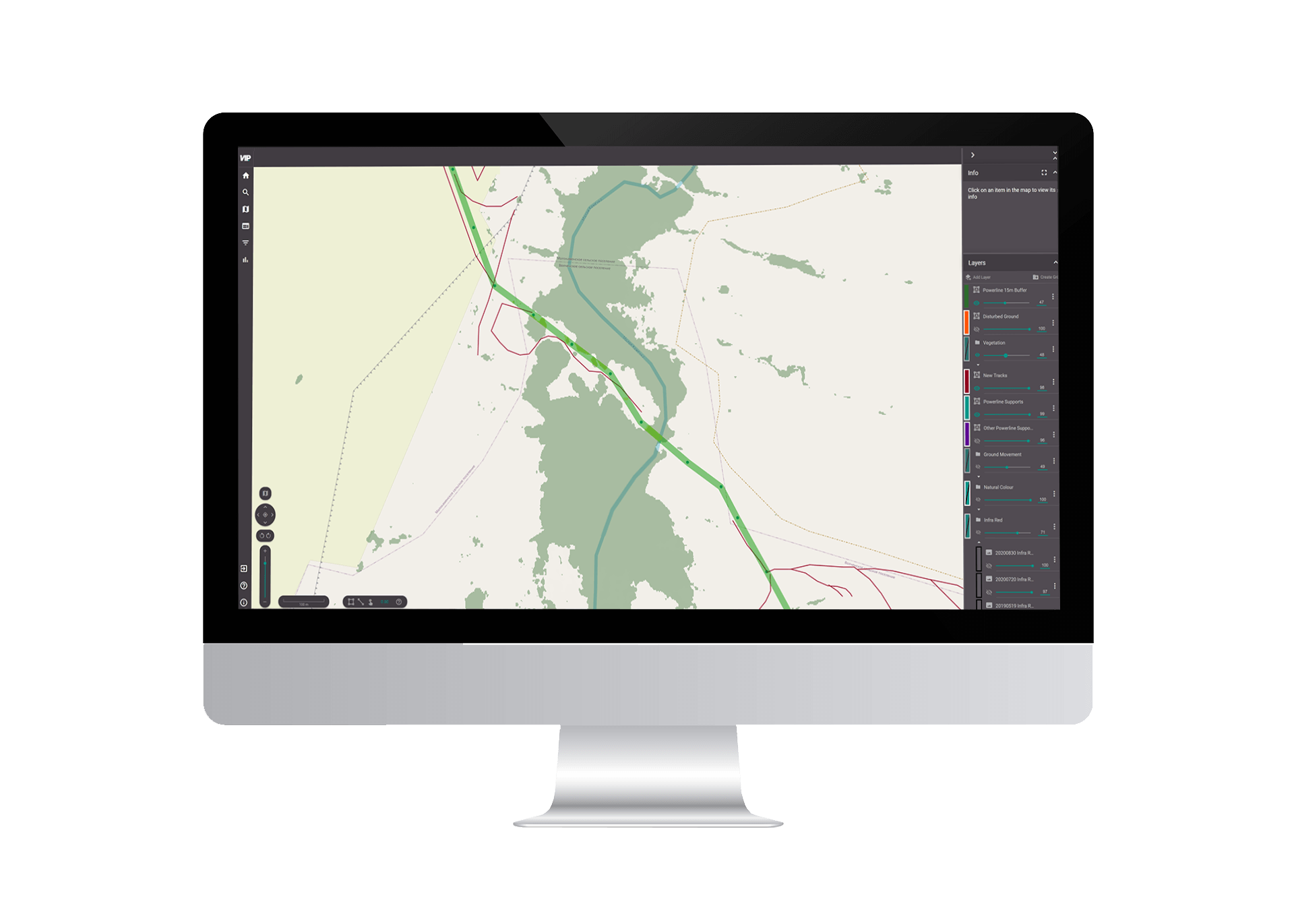
Monitor utility networks through the combination of satellite, aerial and drone imagery and use sophisticated AI software to rapidly and cost-effectively evaluate asset condition.
Remote survey techniques allow maintenance activities to be targeted more effectively, improving network resilience through more regular surveys whilst drastically reducing monitoring costs.
Transmission Networks
Vegetation encroachment management
Integration of 3rd party data to predict incoming hazards
Schedule maintenance efficiently and reduce field time