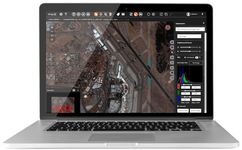
M.App X provides the GEOINT community and security organisations with the tools to exploit imagery and create imagery-derived information products and reports deployed through an enterprise platform.
As an enterprise solution, M.App X can be hosted on the cloud or on-premises to meet security requirements. Its revolutionary approach to visual programming and spatial modeling provides near-immediate feedback and previews for analysing spatial data.
M.App X is for…
… the GEOINT community and security organisations who have a requirement to graphically model raster, vector, and point cloud data to create automated processes that can be executed rapidly and securely, delivering integrated information products to enable timely decisions in the field.
Benefits of M.App X
Cost Effective
M.App X provides all the core requirements in a single platform through a web-based rich client reducing both hardware and licensing costs.
Instant
M.App X’s unique spatial data modeling environment provides near-immediate previews to analyse and geo-fuse data in real time to provide actionable intelligence.
Smart
The cloud-based approach allows both deployed analysts and decision makers to share the same view with instant access to the latest information.
Find out more
M.App X is a cloud-based geospatial solution, utilising the world-leading Hexagon technologies that combine the best in photogrammetry, remote sensing, GIS and cartography. It offers GEOINT organisations the opportunity to securely share, access and examine the latest intelligence.
Interested in using the power of the Spatial Modeler within M.App X? Discover ERDAS IMAGINE.
